


Voting District 0004, Atascosa County, Texas
About
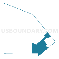
Outline

Summary
| Unique Area Identifier | 670182 |
| Name | Voting District 0004 |
| County | Atascosa County |
| State | Texas |
| Area (square miles) | 123.44 |
| Land Area (square miles) | 123.10 |
| Water Area (square miles) | 0.34 |
| % of Land Area | 99.73 |
| % of Water Area | 0.27 |
| Latitude of the Internal Point | 28.71739610 |
| Longtitude of the Internal Point | -98.30591000 |
Maps

Graphs
Select a template below for downloading or customizing gragh for Voting District 0004, Atascosa County, Texas


Neighbors
Neighoring Voting District (by Name) Neighboring Voting District on the Map
- Voting District 0003, McMullen County, TX
- Voting District 0007, Karnes County, TX
- Voting District 0007, Live Oak County, TX
- Voting District 0008, Live Oak County, TX
- Voting District 0011, Atascosa County, TX
- Voting District 0019, Atascosa County, TX
- Voting District 0021, Atascosa County, TX
- Voting District 0213, Wilson County, TX
Top 10 Neighboring County Subdivision (by Population) Neighboring County Subdivision on the Map
- Jourdanton CCD, Atascosa County, TX (5,989)
- Three Rivers CCD, Live Oak County, TX (4,615)
- Poth CCD, Wilson County, TX (3,717)
- Falls City CCD, Karnes County, TX (1,490)
- Tilden CCD, McMullen County, TX (707)
- Campbellton CCD, Atascosa County, TX (503)
Top 10 Neighboring Unified School District (by Population) Neighboring Unified School District on the Map
- Pleasanton Independent School District, TX (17,159)
- Jourdanton Independent School District, TX (6,218)
- Karnes City Independent School District, TX (4,642)
- Three Rivers Independent School District, TX (4,269)
- Poth Independent School District, TX (3,754)
- Falls City Independent School District, TX (1,745)
- McMullen County Independent School District, TX (707)
Top 10 Neighboring State Legislative District Lower Chamber (by Population) Neighboring State Legislative District Lower Chamber on the Map
Top 10 Neighboring State Legislative District Upper Chamber (by Population) Neighboring State Legislative District Upper Chamber on the Map
Top 10 Neighboring 111th Congressional District (by Population) Neighboring 111th Congressional District on the Map
Top 10 Neighboring Census Tract (by Population) Neighboring Census Tract on the Map
- Census Tract 9601, Atascosa County, TX (6,972)
- Census Tract 9606, Atascosa County, TX (5,989)
- Census Tract 9501, Live Oak County, TX (4,615)
- Census Tract 6, Wilson County, TX (3,717)
- Census Tract 9701, Karnes County, TX (2,214)
- Census Tract 9501, McMullen County, TX (707)
Top 10 Neighboring 5-Digit ZIP Code Tabulation Area (by Population) Neighboring 5-Digit ZIP Code Tabulation Area on the Map
- 78064, TX (14,102)
- 78118, TX (3,976)
- 78113, TX (2,435)
- 78012, TX (436)
- 78008, TX (345)
- 78075, TX (123)